Delhi Heat Index Hits 50.7C as Safdarjung and Lodi Road Record High Temperatures
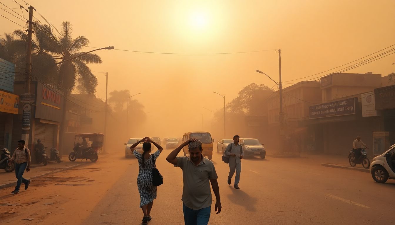
Delhi experienced severe heatwave-like conditions on Sunday as the heat index, or "real feel" temperature, peaked at 50.7°C, with official weather stations at Safdarjung and Lodi Road recording temperatures significantly above normal alongside an evening dust storm.
According to the India Meteorological Department (IMD), high humidity levels ranging between 37% and 70% combined with high air temperatures to push the heat index to extreme levels. The index was recorded at 50°C at 2:30 p.m. before peaking at 50.7°C by 5:30 p.m. Even late at night, the feels-like temperature remained high, measuring 49.1°C at 11:30 p.m.
The Safdarjung weather station, which serves as the city's base temperature marker, recorded a maximum temperature of 41.8°C, which is 4.6°C higher than normal. The Lodi Road station recorded a maximum temperature of 42.1°C, which is 5.1°C above normal. The minimum temperature across the city stood at 31.1°C, about 3.2°C higher than normal.
The city also recorded high wet-bulb temperatures on Sunday, reaching 28.1°C at 2:30 p.m. and peaking at 29.5°C by 5:30 p.m. Wet-bulb temperatures measure the lowest temperature achievable through evaporative cooling. While a wet-bulb temperature of 32°C makes prolonged outdoor work difficult, a reading of 35°C prevents the human body from regulating its temperature, potentially leading to heatstrokes.
In addition to the heat, a dust storm hit the city on Sunday evening. Strong winds were recorded across various stations, with Palam tracking wind speeds of 70 kmph at 5:25 p.m., followed by Pusa recording 56 kmph at 6:00 p.m. Safdarjung recorded a peak wind speed of 32 kmph at 5:33 p.m.
Mahesh Palawat, vice president of Skymet Weather, explained that southwesterly winds from the Arabian Sea are carrying moisture into northwestern India. This influx has raised humidity levels, keeping the feels-like temperatures high.
Relief is expected later in the week. The IMD forecasts that maximum temperatures will gradually fall to between 33°C and 35°C by Friday, with rain and thunderstorms predicted through Saturday. However, the onset of the monsoon remains delayed, with experts expecting its arrival only after July 4.